
|
|
||
|
|
|
|
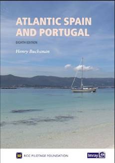
Atlantic Spain and Portugal, eighth edition
The guide covers the region from Cabo Ortegal to Gibraltar and is the essential companion for yachts passage making from Northern Europe to the Mediterranean or onwards to the Canaries before an Atlantic crossing. It is also vital for yachts crossing the Atlantic from the Americas and a comprehensive cruising companion for anyone visiting the delightful cruising grounds found along the Atlantic coast of the Iberian Peninsula. 'Atlantic Spain and Portugal' is the classic guide to this varied coast which includes the Rias of Galicia, the estuaries of the Douro and Tejo with Lisbon, the Algarve and then the coast of Andalucia down to Gibraltar. It's one of those books that you refer to daily while underway or when planning your cruise. It is a typical pilot book with information about the
anchorages and marinas, but little about the shoreside activities. As happens
with any book that has detailed information, it goes out of date as soon as its
in print. For this reason, a free supplement is available online twice a year
with updated information. The book has fallen prey to the dreaded predictive
text and spellchecker monster with errors introduced in words like 'chartered'
instead of 'charted'. There are also some inconsistencies when it comes to
where to look for items of information such as which channel a marina monitors.
We took these in stride given the volume of useful information contained in the
book. As of the 20th of June 2019, the new 8th edition of this
pilot published earlier in 2019 is now available for download as a pdf eBook
from the Google Play store. You can download it here. It is also
available in Spanish and French. Significantly, the book, as mentioned above, includes a voucher to download Imray Chart set ID40 for the Imray Navigator app. Once you download the app from Google Play and set up an account in the app, you'll have to navigate to subscriptions in the app to select the charts to download. Be warned, the two sets of charts contain over 1 GB of data and took over an hour to download over WiFi and several failed attempts with 4G. Each collection of Imray charts for the app costs £22.99 for a one-year subscription. It's not a perfect world though. Although the digital maps
appear to be faithful to the paper ones, there is a glitch in the zoom level
when moving between maps. Essentially, the two sets of charts in the two
digital downloads for the region don't match up exactly. This often happens
with paper charts, but it is not expected nor does it inspire confidence with
the digital ones. Of course, there are major warnings about not using the
charts for navigation, but they are still useful as a backup and to have along
in the dinghy. The very first version of their app was launched June 1 so
glitches are to be expected. Imray has plans for updates including· Tracking · Route planning · Waypoints · Full tidal predictions when used in conjunction with Imray’s Tides Planner app, sharing across devices · Content from Imray pilot books including marina and anchorage details and sailing directions. · AIS and NMEA integration Additional Information
|
|
|||
|
Europe: Port Aleria, Rosnakilly, Kilmeena, Westport, Co. Mayo, Ireland - USA: PO Box 726, Mahwah, NJ 07430 All content on this site is subject to Copyright© - All rights reserved. Contact us - Advertising - Privacy - Terms & Conditions - Copyright & Trademark - Webmaster |
 Before
we say anything about the book, we must shout out that it comes with a free
one-year subscription to the full set of electronic charts for the region
covered by the book. Imray has released a new app for iPhone and Android for
the display of their charts, and it's pretty interesting. This is a game
changer for a book that costs £45.
Before
we say anything about the book, we must shout out that it comes with a free
one-year subscription to the full set of electronic charts for the region
covered by the book. Imray has released a new app for iPhone and Android for
the display of their charts, and it's pretty interesting. This is a game
changer for a book that costs £45. 